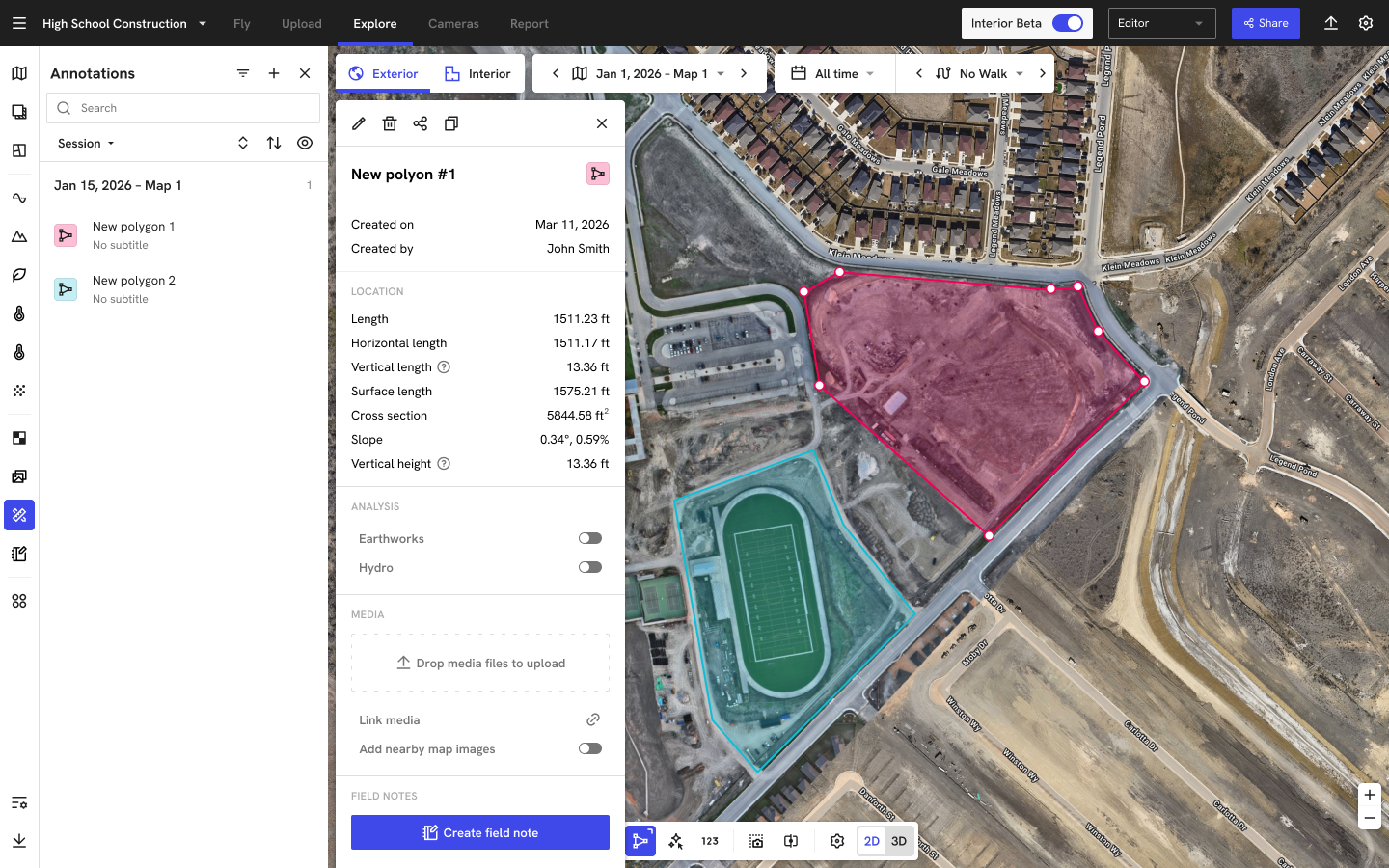
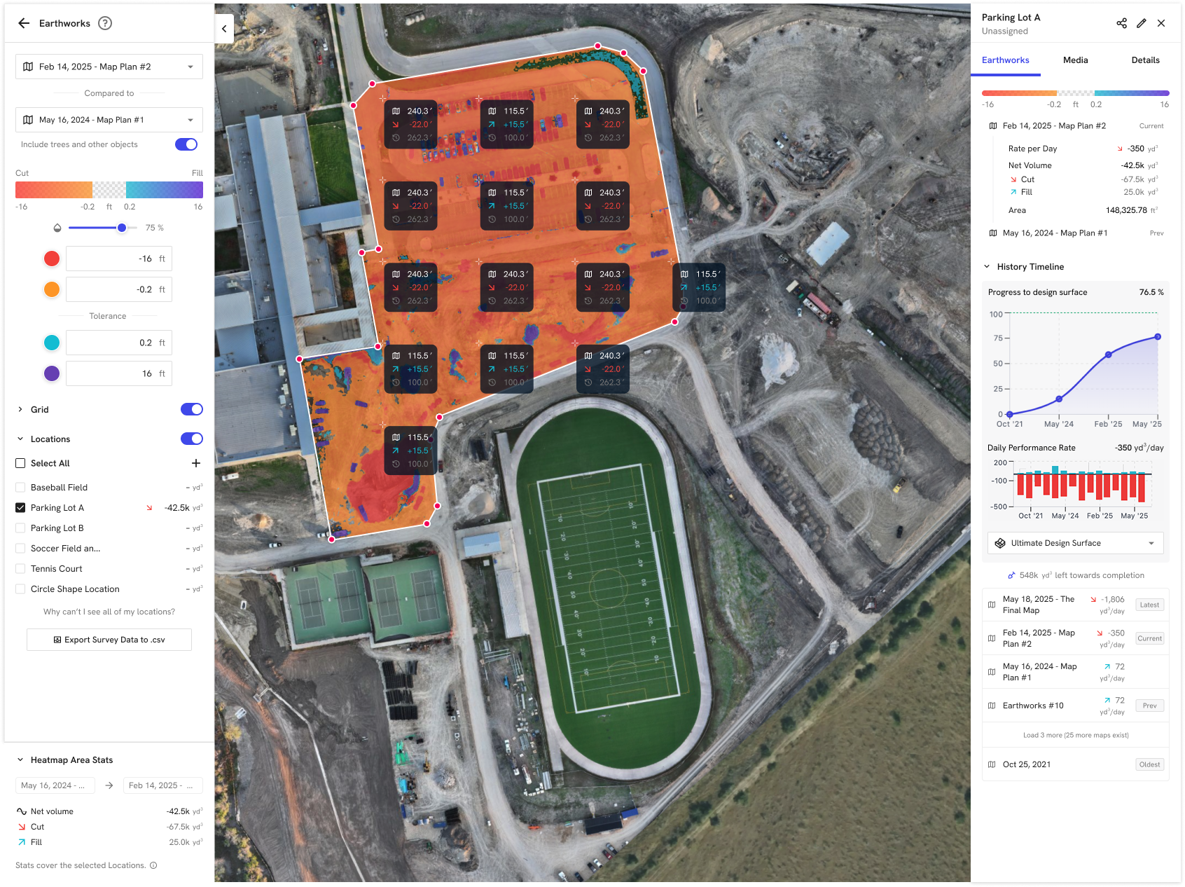
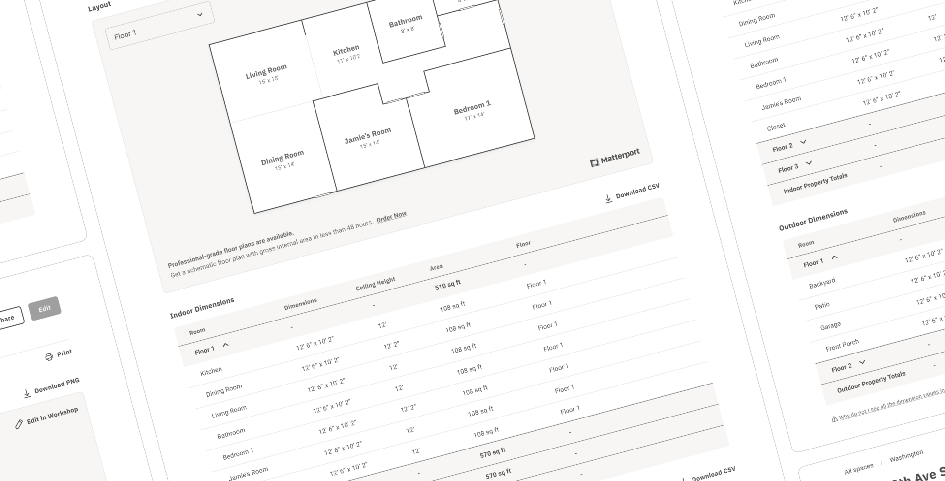
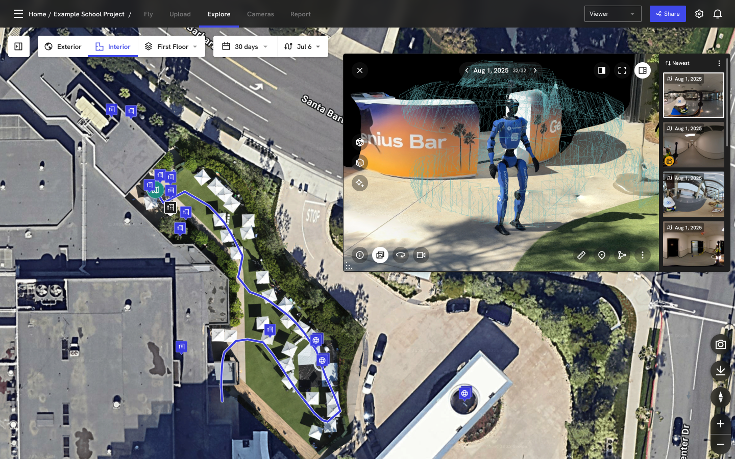
Problem:
Our 3D experience on DroneDeploy had grown into a patchwork. Tiles, panos, and ground walks all used slightly different viewers, controls, and measurement patterns, depending on where you entered the product. For customers, this meant 3D measurement—the core job in many workflows—felt inconsistent and hard to trust across views. Internally, it also meant that every new 3D feature (walks, splats, overlays) required bespoke UX and one-off implementation, making it slow and risky for teams to build on top of 3D.
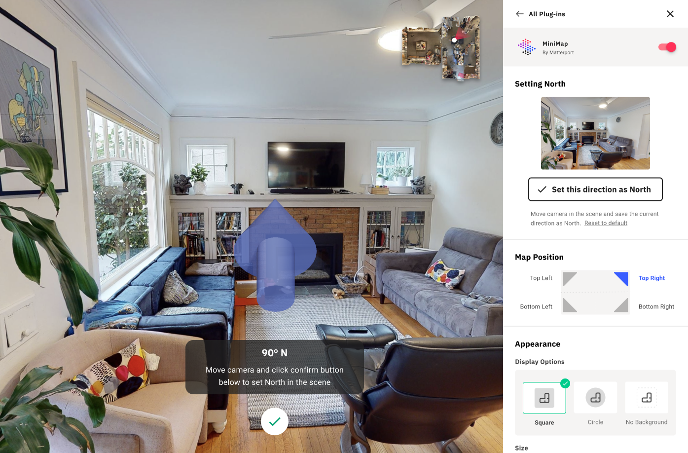
Solution:
I partnered with the 3D team to define Omni Viewer as a single, unified 3D experience that could sit behind any aerial or ground context. From a product and UX perspective, we:
- Clarified the primary jobs—navigate the scene, switch between pano/dollhouse, and measure reliably in 3D.
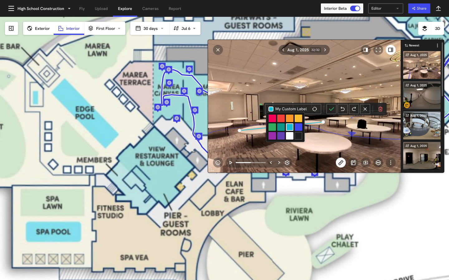
- Designed a small, reusable set of building blocks (scene, walk view, pano view, shared measurement mode) that behave the same whether you come from a map, a walk, or a project link.
- Created an "embedded" version of the viewer for other teams that exposes only simple inputs (project, plan, starting view), so they can add full 3D + measurement to their flows without custom work.
This shifted 3D from "a special thing you go to" into a consistent capability across the product, and gave us a single place to evolve 3D measurement and navigation over time instead of reinventing them feature by feature.
⚠️ Case study is available upon request. ⚠️