Problem:
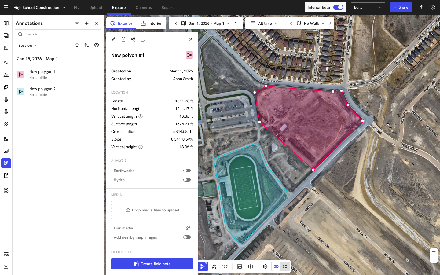
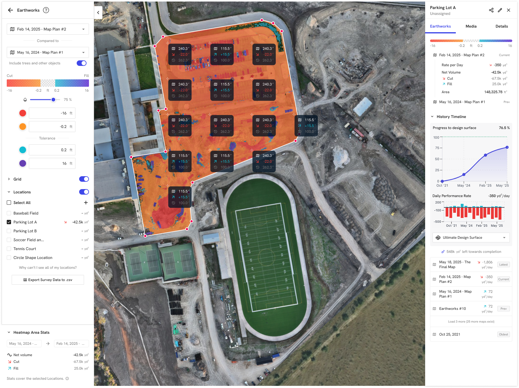
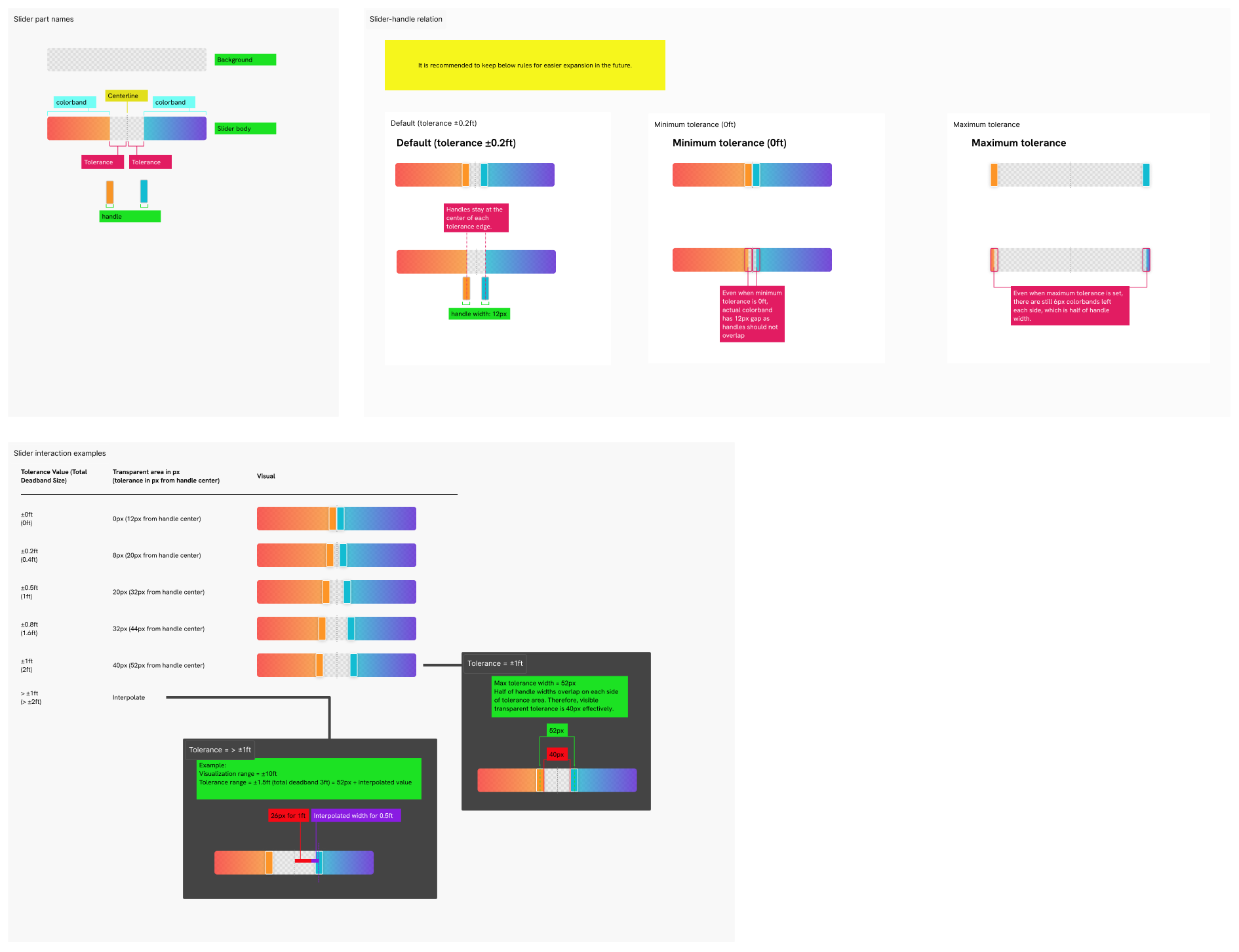
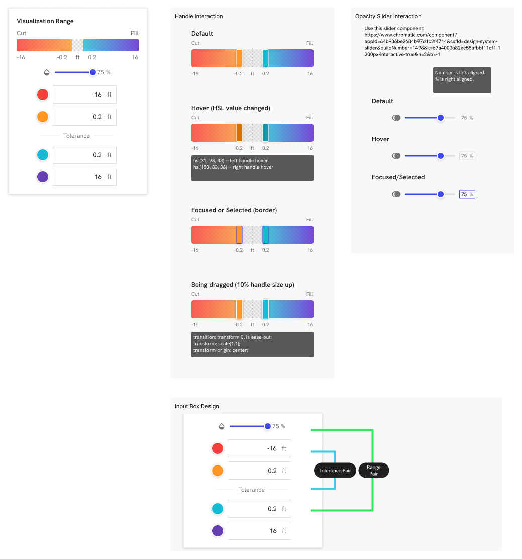
On DroneDeploy, high-accuracy mapping was both mission-critical and fragile. Enterprise customers were misusing GCPs, mixing coordinate systems, and flying without enough survey structure, which led to a high rate of "inaccurate" maps on flagship jobs. That eroded trust, created rework for survey teams, and opened the door for competitors like Propeller. In earthworks specifically, teams were relying on color gradients alone to interpret cut/fill, making it hard to quantify precise elevation changes without time-consuming workarounds or switching to competitors with better numeric grid visuals. At the same time, we had already shipped powerful accuracy features (RTK/PPK, project-level GCPs, terrain edit, elevation profiles, design overlays), but they were scattered across the product, hard to discover, and essentially "given away" without a clear, end-to-end workflow or value story.
Solution:
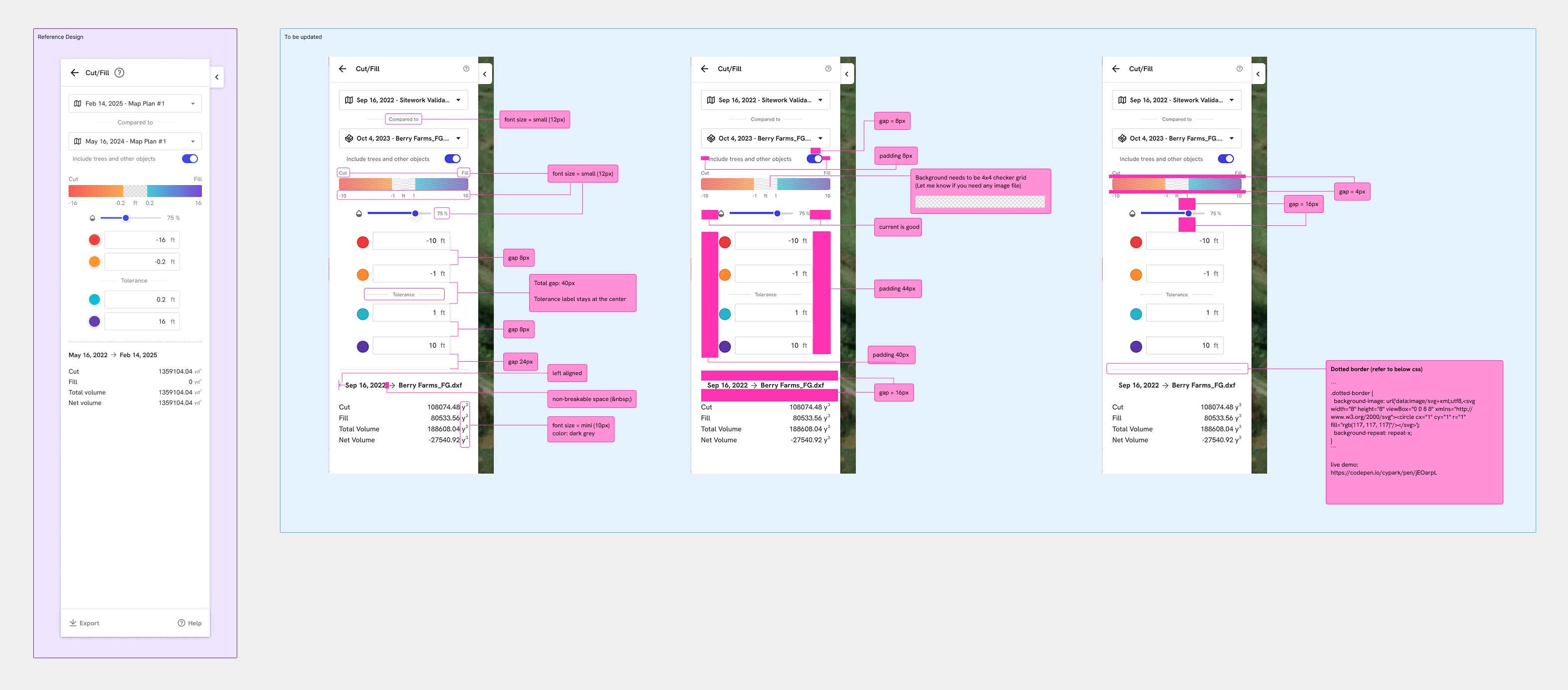
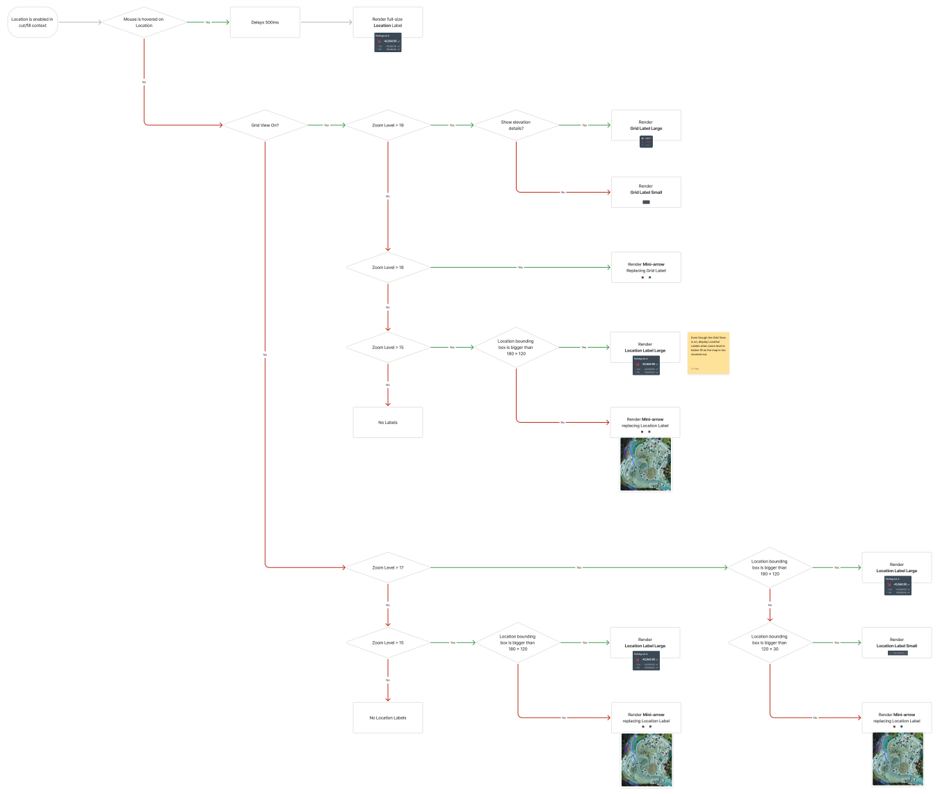
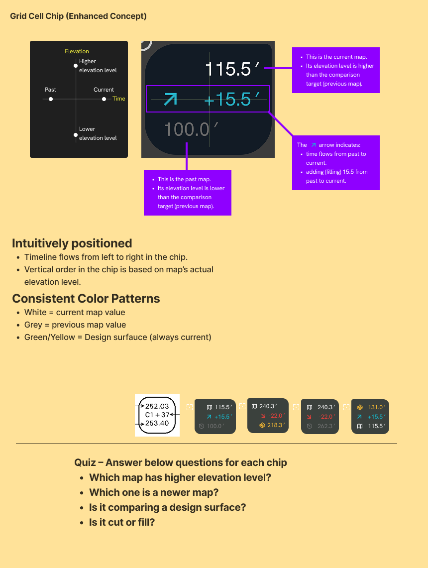
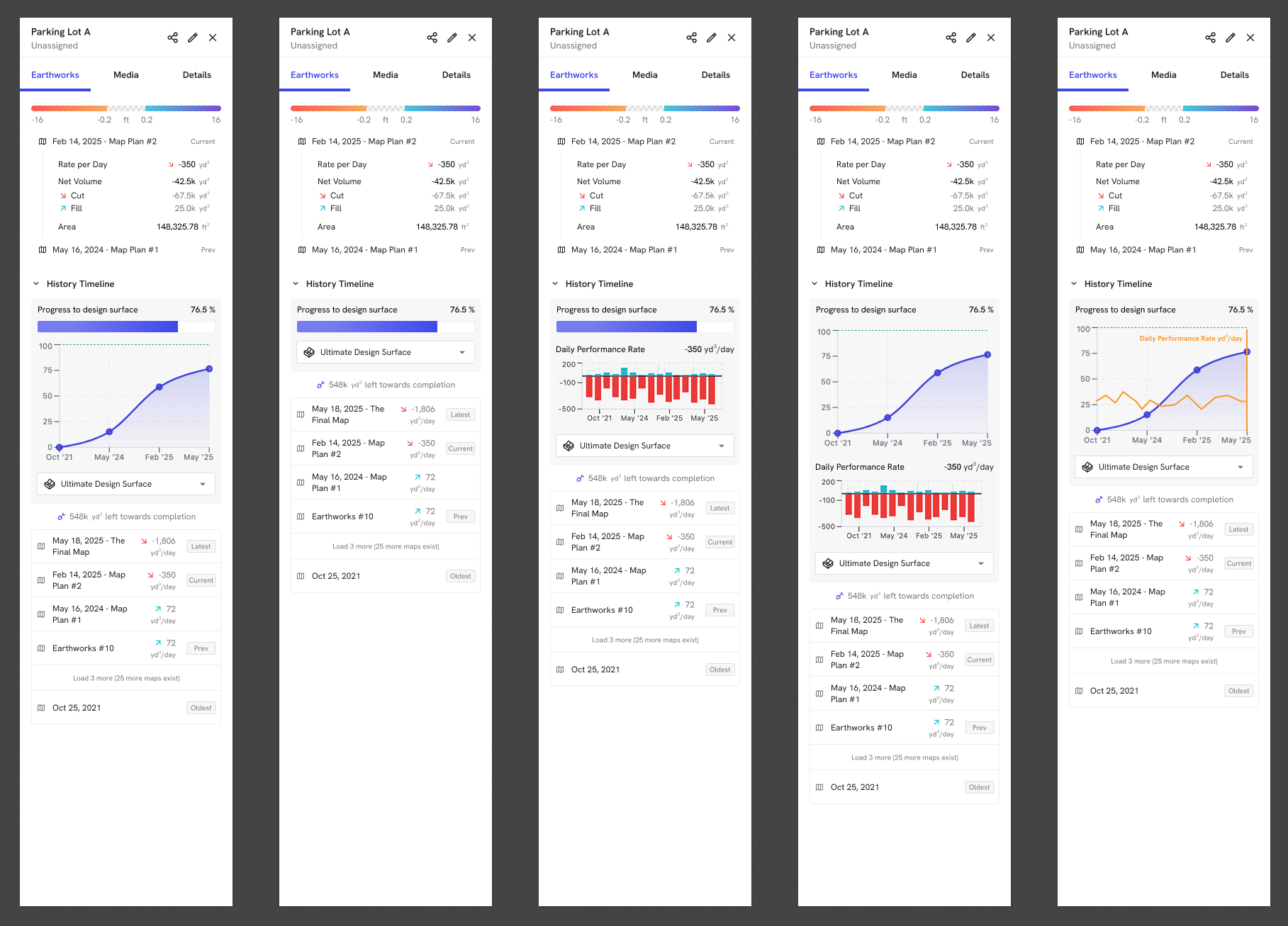
I helped design Advanced Survey as a single, survey-focused experience that bundles these tools into a guided, upsellable product. On the UX side, this meant clarifying the core jobs (capture, control, validate, and report), simplifying setup flows around RTK/PPK and GCPs, and introducing accuracy-first patterns like controlled map filters, accuracy alerts, and more legible elevation/earthworks views. As part of this, we introduced Grid View, which overlays a uniform grid with labeled elevation-change values so teams can scan a site, QA work, and monitor progress in a way that matches engineering expectations. On the product side, I partnered with PM and engineering to align the UI with a new org-level SKU, so survey managers see one cohesive "survey mode" rather than a patchwork of advanced toggles. The result is a clearer path to reliable, repeatable accuracy for customers—and a differentiated, revenue-generating accuracy story for DroneDeploy.
Impact:
Qualitatively, this work made accuracy feel tangible instead of abstract. Survey leads now use Grid View screenshots to walk supers and owners through exactly where dirt moved and how much, which has reduced back-and-forth over reports and helped de-escalate disputes. Internally, sales and CSMs stopped pitching a grab bag of "advanced features" and started telling a single Advanced Survey story, which has made it easier to position DroneDeploy as the primary survey tool rather than a nice-to-have viewer layered on top of traditional workflows.
From a metrics standpoint, we instrumented Advanced Survey in Mixpanel with dedicated events and MAU slices for key workflows (Grid View interactions, RTK/PPK usage, controlled maps, Managed Accuracy alerts). Cut/Fill Grid View (launched ~Jan 2026) ramped from 0 to 75 unique users by its second full month (Mar 2026), with 127 unique users touching the feature over the last three months; related events like Grid Setting Changes and Elevation Details show similar early traction. Cut/Fill Comparison workflows (launched ~Jul 2025) grew from 202 MAU at launch to 514 MAU by Mar 2026—about a 2.5× increase in nine months. Those Mixpanel trends gave us a concrete adoption story for ELT and GTM reviews: usage was concentrating in the right accounts, growing steadily over time, and signaling that Advanced Survey was changing how teams measured dirt week over week rather than being a one-off "power user" feature.
⚠️ Case study is available upon request. ⚠️